MY
COLLECTION
UK MAP POSTCARDS BY DESIGN
M. F. Peck
|
Marian
Fielding Peck (known as Maisie) was most famous for her painted maps
published by J
Salmon Postcards from 1953 to the present (though the company
ceased production in 2017). Norfolk was the first of 61 map postcards
she produced for them in their series of 70* maps from around the
UK. As Maisie lived in and loved Norfolk for most of her adult life,
she also produced other maps of locations in Norfolk that were not
published by J Salmon, with the exception of a modified and coloured
version of Norwich. As it was, Salmon had more maps in their series
based around Norfolk than of any other place, thanks to Maisie. |
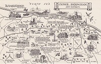 Cromer, Sheringham and District |
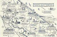 North East Norfolk |
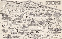 North Norfolk |
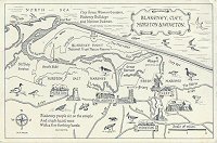 Blakeney, Cley, Morston & Wiveton |
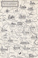 Weston Longville and Neighbourhood |
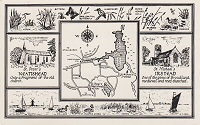 Neatishead & Irstead |
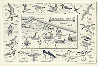 Blakeney Point |
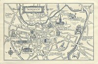 Norwich |
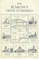 The Blakeney Group of Parishes |
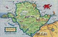 Anglesey |
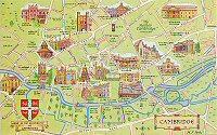 Cambridge |
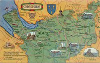 Cheshire |
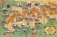 The Chiltern Hills |
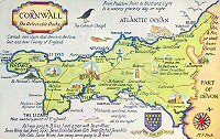 Due-West Cornwall |
 Cornwall |
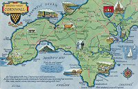 South West Cornwall |
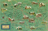 The Cotswolds |
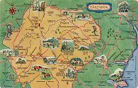 Dartmoor |
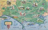 Dorset |
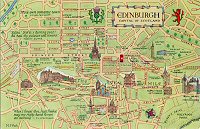 Edinburgh |
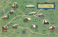 Epping Forest |
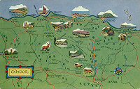 Exmoor |
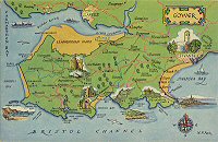 Gower |
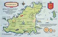 Guernsey |
 Hampshire |
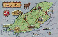 Isle of Man |
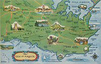 Isle of Purbeck |
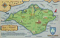 Isle of Wight |
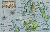 The Isles of Scilly |
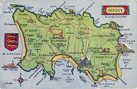 Jersey |
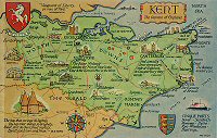 Kent |
 Lleyn Peninsula |
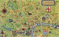 London |
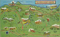 Lorna Doone Country |
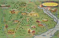 The New Forest |
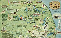 Norfolk Broads |
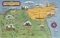 North East Kent |
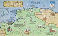 North Devon |
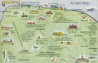 North Norfolk |
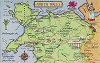 North Wales |
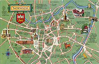 Norwich |
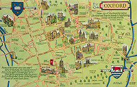 Oxford |
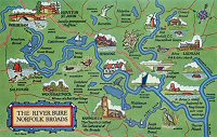 River Bure |
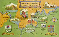 River Thames |
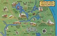 River Thurne |
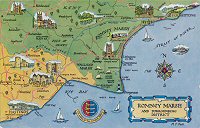 Romney Marsh |
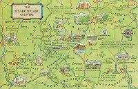 Shakespeare Country |
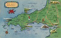
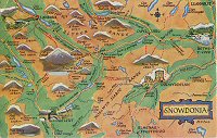 Snowdonia |
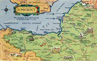 Somerset |
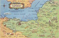 Somerset and Avon |
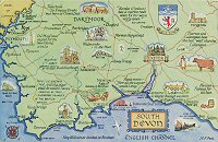 South Devon |
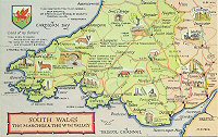 South Wales |
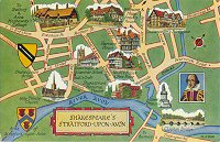 Stratford upon Avon |
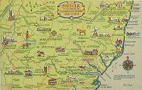 Suffolk |
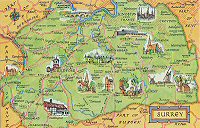 Surrey |
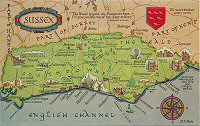 Sussex |
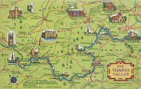 Thames Valley |
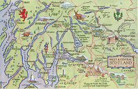 West and Central Scotland |
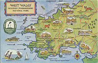 West Wales |
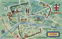 York |
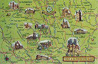 Yorkshire Dales |
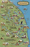 The Broads |
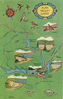 Elan Valley Lakes |
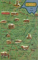 The Fens |
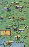 The Lake District |
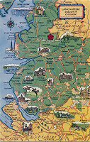 Lancashire |
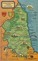 Northumberland |
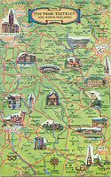 The Peak District |
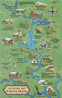 River Ant |
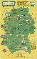 Wiltshire |
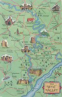 Wye Valley |
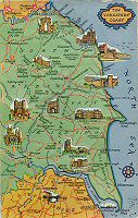 Yorkshire Coast |
|
Most of the maps were subsequently re-printed as continental size postcards, firstly with green borders with the map itself remaining exactly the same size as the original release maps, then without green borders and the map expanded in size to fit the card. These and further releases are not featured in this gallery - See J Salmon Gallery. |
|
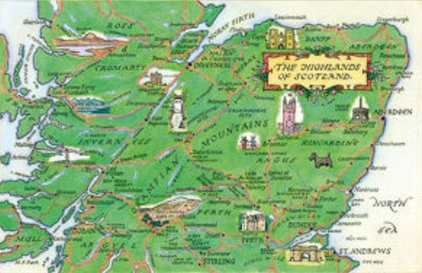
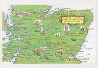
In
addition, a couple of websites specialising in 'prints' for a while
were offering full size prints of some of the M F Peck maps by Salmon
and one map in particular stood out as it had never been seen before
as a postcard (to my knowledge) and no-one I have been in contact
with knows anything about it. It is an M F Peck design with her signature
and features 'The Highlands of Scotland'. I do know that shortly before
the postcards began to be issued in continental size, Salmon withdrew
from doing Scotland map postcards (which is why there are no continental
size maps of areas in Scotland), so maybe this was one due to be released
in the original series but never was.
|
|||
 |
|||
|
Thanks
to Michael Carr for gifting me this postcard published by the Mary Evans
Picture Library at mediastorehouse.com which re-produced the above Highlands
of Scotland map.
|
|||
 The Highlands of Scotland No Code |